
Shanghai Geography: River, Delta and Coast
Shanghai lies on the Yangtze River Delta, where the Huangpu River links the central city to the estuary. For a first visit, trace the Huangpu waterfront before adding a distant island or wetland.
- Core waterway: the Huangpu River runs between the Bund and Pudong.
- Northern edge: the Yangtze estuary meets the East China Sea.
- Map scale: Chongming Island belongs to Shanghai but is far from People’s Square.
How Does the River Shape the City?
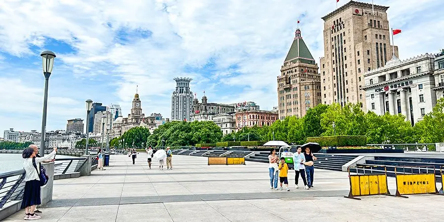
The Bund is on the west bank of the Huangpu. Lujiazui faces it from Pudong on the east bank. That short river crossing explains two very different skyline views.
The Suzhou Creek joins the Huangpu near the Bund’s northern end. A waterfront walk can show the creek junction, older port buildings and modern towers without leaving central Shanghai. See our Shanghai history guide for the port story.
Where Are the Delta and Coast?
Shanghai occupies low land near the Yangtze mouth. Water, deposited sediment and engineered banks helped shape the city and its transport routes. A central skyline photograph shows only a small part of this municipality.
Chongming Island sits in the estuary, north of the central city. Its wetlands and rural areas need a separate outing. Do not place an island reserve between two downtown appointments.
What Can You See in One Visit?
Start at the Bund for the river and Pudong skyline. Cross by a current public route if you want the reverse view from Lujiazui. Give the crossing and station walk their own time.
For a second water story, follow a public section of Suzhou Creek. The Bund waterfront guide helps choose a practical viewing stretch.
When Does Geography Affect Plans?
A summer river walk can feel hotter and more exposed than a museum visit. In heavy rain or strong wind, choose a short waterfront stop and a nearby indoor activity.
Distance matters more than the city name on a map. A Chongming wetland, a Qingpu water town and People’s Square are separate areas. Choose one outer district for a full day.
What Map Mistakes Cause Detours?
Do not confuse the Huangpu River with the Yangtze River. The Bund fronts the Huangpu; the Yangtze estuary lies farther north.
Do not use a straight-line distance across water as a travel time. Bridges, tunnels, ferries and station approaches use different routes. Select the actual crossing before setting a meeting point.
FAQ: What Should You Know?
Is the Bund on the Yangtze River? No. The Bund faces the Huangpu River. The Yangtze estuary lies north of central Shanghai.
Is Chongming Island in Shanghai? Yes. It is part of Shanghai municipality. Reaching a specific wetland takes longer than crossing the central Huangpu.
Can I see both riverbanks in a half day? Yes, if you keep the route central. Allow time for the actual crossing and walks at both ends.